Responses and Task Assignments Resulting from June 2020 Recommendations to City Manger
In Progress Tasks:
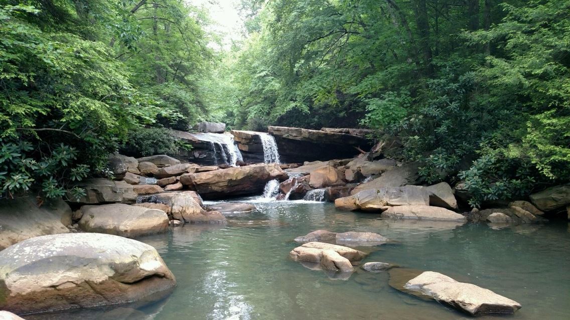
3. Maintain and/or improve fishing access spots.
Initial Recommendation:
There are multiple access points for fishing along the Riverfront that are consistently being used by the public. We recommend that the City investigate these spots and address any infrastructure maintenance issues (such as the stairs at the access point behind the power plant and the concrete access ramp next to the dam), cut back weeds, and erect consistent, friendly signage. Currently some spots have five different signs, and some have none at all. Our goal is to let the community know about these access points and to denote them with friendly signs that also communicate all required information (such as that related to NPDES permits).
Response Update 9.17.20:
- BOPARC cleared the weeds around the HRM Dock but does not control any of the other fishing access areas Frank assessed, aside from the Marina behind Table 9.
- Frank recommends doing nothing to the access by the lock and dam because it is controlled by the Corps. He fears the Corps will cut off all fishing if we bring the area to their attention.
- The fishing access behind the power plant is no longer under lease by the City. The owners approached the City to re-lease it but did not respond well when the City’s conditions (including a prohibition on weapons) were presented. The City has not pursued this further.
- Frank is going to look into convening a volunteer group to do the minor maintenance on the remaining fishing access spots he identified that are not currently being maintained by the City or BOPARC. He recommends only minor trimming of brush that obscures the path and doesn’t believe it will take long to do.
Response Update 8.20.20:
Frank provided a list of 10 fishing access points between the Morgantown Lock and Dam and the Power Plant behind the Seneca Center with a description and recommendations for each. Most recommendations involve minor brush clearing and better signage. Frank is still working on figuring out the requirements for the MUB signs that deter people from entering the water.
Jessica will send Frank’s recommendations to Marchetta and BOPARC so they can work on the easy maintenance tasks he mentioned. Jenny asked that Japanese knotweed also be discussed, as it’s overgrowing and interfering with the docks. Ella will pull in Zach, who’s dealt with this in the arboretum.
Frank is working on trying to get more info on the MUB signs about staying out of the river. Frank has also talked to DNR about replacing the fishing signs that already exist. He does not recommend adding signs to the informal fishing spots that don’t have signs currently.
Response 7.16.20: Frank will lead the effort to assess the fishing access points and provide a list of what needs to be done at each fishing access point. The list should include what’s absolutely necessary and what could be done but isn’t an immediate need, as well as information on the specific location of each access point.
(One way to do this is by adding ideas to this map: https://www.arcgis.com/home/webmap/viewer.html?webmap=abb81fb0162a4fe8bad3df3146acdfa0&extent=-80.0768,39.5723,-79.8232,39.6817)
4. Improve viewshed.
Initial Recommendation:
We recommend the City selectively cut and remove invasive brush and small trees along certain areas of the riverbank to improve the view of the water while maintaining the integrity of the bank. Our vision includes leaving large, beautiful trees and other plants that keep the bank stable.
Possible locations where this would be beneficial include:
- Straight across from the Marriott’s Conference Center courtyard
- Opposite the Caperton Trail archway near mile marker 10
- Across from Flour & Feed
- Across from Mountain State Brewing and Oliverios
Response Update 9.17.20:
- On September 2, Jessica met with Marchetta Maupin (Urban Landscape Director), Dave Barnett (President of Morgantown’s Tree Board), Jenny Selin, and Kristen Wickert, a plant pathologist at WV Department of Agriculture (WVDA), at the riverfront to look at the proposed management areas.
- As a result of that discussion, Kristen and Jessica drafted a working plan to handle invasive species and sent it to Marchetta, Dave, and Jenny on September 16 for feedback by September 30.
- The Northern Brownfields Assistance Center has assigned its landscape architecture intern to help with this project. She will prepare renderings to show what the managed areas will look like after invasive species are removed and new plant material is planted.
- Once the plan is approved, Kristen and others at the WVDA and USDA may be able to use it in proposals to seek funding to treat invasive species along the riverfront.
- Once the plan is approved, Task Force members will meet with riverfront business owners located opposite the proposed management areas to share the draft plan, solicit feedback, and offer various levels at which they can contribute financially to help execute the plan.
Response Update 8.20.20: Jessica met with Marchetta Maupin and David Mitchell, who owns Mitchell Tree Care, LLC, on 8/19/20 to get an estimate of costs. David estimated it would cost $4,000 to cut and treat invasives between the green fence and the bike rack across from the entrance to the Caperton Trail. Doing all four recommended areas would be roughly $20K.
Jenny suggested convening a committee, including herself and Frank, to look into how this could be done incrementally and more cost effectively. Jessica will reach out to Marchetta to find out what time of year is best to do this and facilitate a meeting of the group to see how this could be done on more limited basis.
Response 7.16.20: Emily will ask the landscape director to find an expert and figure out how much it will cost. Jenny would like to be involved.
5. Work with Convention & Visitors Bureau (CVB) and Mon River Trails Conservancy (MRTC) to find a place for maps & visitor info.
Initial Recommendation: We want trail users and visitors to be able to get trail maps, water maps, and visitor information. The CVB has offered to stock maps at a Riverfront location. We recommend you work with both the CVB and MRTC to find the most sensible locations to make this information available.
Response Update 9.17.20:
- Mary and Ella installed maps at the new structure the City built at Walnut Street landing.
- Vincent is drafting rules for HRM Park. Once those are finalized, they will be posted in the kiosk Mainstreet Morgantown has in the Park. Underneath the rules will be a trail map. There will also be a place to obtain trail maps nearby.
- There are many water maps available as well; Task Force members recommended placing these at Walnut Street Landing. We just need a holder that will mount on the sign holder so these can be placed.
Response Update 8.20.20: Susan Riddle doesn’t think CVB info needs to be in the Park. The City plans to create a dispenser for trail maps in a kiosk in the Park.
Update: CVB is giving dispenser to hold trail maps. Park rules will be at top and a map will be underneath. The City will also look at a place to put water maps.
Response 7.16.20: Emily is working with Mainstreet to use the kiosk that’s in HRM Park. The Task Force wants water maps, rail trail maps, and visitors guides to be available. Emily would like Ella and Susan Riddle to identify locations along the trail to place these maps, not just at HRM Park.
7. Work with the Bike Board and MRTC to thoughtfully replace, relocate, and install bike racks.
Initial Recommendation:
We recommend that the City engage the Bike Board and MRTC to comprehensively assess all the bike racks along the Riverfront and remove those that aren’t working, relocate those that are to better locations where needed, and install new ones. Our goal is to maximize the ability of cyclists to use Riverfront amenities while minimizing damage to trees and other infrastructure that might come from unplanned bike parking.
Response Update 9.17.20: Drew Gatlin is actively working with the Bike Board to assess current racks and determine what changes are needed. He will have an update at the next meeting. He is also going to coordinate with Ella to get her that data in a way that will help her understand new rack needs and seek funding if needed.
Response Update 8.20.20: The City installed a temporary bike rack donated by Pathfinder to MRTC, which is now in between the bathrooms and the old deport at HRM Park. Everyone agrees this is a logical location for a rack. That rack will stay for the next couple months and replace it in the spring with new racks. MRTC will pay for U racks in the future; they have the money and can move forward faster if needed. Ella needs people to let her know how that temporary rack is being used to try to determine what is really needed there.
Drew Gatlin reconvened the Bike Board for the first time in about 2 years; they will map existing racks and make a list of what changes are needed.
Main Street plans to add a map to the kiosks it has in the Wharf at HRM Park and next to the Marriott and replace the current poster of business listings. They will add bike rack locations to those maps. Jessica will send Barb the list Frank put together of fishing spots so those can also be included.
Response 7.16.20: Emily wants the Bike Board to lead this effort and consult with Ella.
8. Make trail connections.
Initial Recommendation:
We recommend that the City connect the south end of the paved trail that runs through South University Avenue Park to the Rail Trail so that there is no break in pavement between the two.
We also recommend that the City take any steps necessary to improve access to the existing Meadow Lane right-of-way that runs between the First Ward neighborhood through the woods down to Don Knotts Boulevard, directly across from the free trail parking at South University Avenue Park. This section has been identified by multiple community groups, including the Greenspace Coalition and MRTC, as an important neighborhood-to-trail connection, and some funding has been obtained to formalize that connection.
Response Update 9.17.20:
- Mel with BOPARC asked for a written plan for South U Park, with funding options identified, by October 1 because multiple ideas have been presented for the Park, including connecting the Park’s trail to the rail trail.
- Because the proposed trail connections may be affected by future plans, they have been placed on hold for now while other ideas are fleshed out.
- Several Task Force members are meeting with Danny Twilley, Greg Corio, and Vaike Haas on September 23 to discuss their ideas for South U Park. Based upon the outcome of that meeting, the other stakeholders Mel identified will be brought in for a bigger discussion about the Park plan.
Response Update 8.20.20: Jessica met with city engineer Damien Davis to get an estimate of the cost of making connections. Damien estimated that it would cost $5,000-10,000 for Public Works to connect the trail at the south end of the park and to pave a short connector between a memorial evergreen tree and the trail.
The City’s new bike/ped plan and the mountain bike trail plans currently being developed by the International Mountain Biking Association both recognize the need to connect the White Park trails to the Rail Trail. The City has applied but not received grants to assist with this effort at least twice. Many prefer a bridge that crosses over Don Knotts Blvd. and acts as a visible and beautiful gateway to the City. There are no immediate plans for this, but the idea needs to be kept in mind for the future.
This and other discussions led Mel Wiles to initiate the creation of a stakeholder group to discuss and come up with a plan for South U Park. WVU’s Outdoor Economic Development Collaborative is considering the south end of that Park for a bike skills park and Jessica and Patrick have been looking into placing a man-made climbing boulder there (both ideas could work together). Mel would like the group to come up with a plan by October 1 and then move on to planning and obtaining funding after that. Any plan for this Park must also take into consideration the hydroelectric project that is still in the planning phase.
Jessica will contact Ryan Simonton who agreed to inquire with DOH as to whether it would be willing to sell or donate the park to the City.
Response 7.16.20: Emily wants Jessica to help set the course of connecting South U Park path to rail trail. Ella wants to help with this too. City is getting money from Dominion Gas for 8th Street project and is looking at doing more neighborhood-trail connections.
10. Add information on City website about how to hold events at the Riverfront.
Initial Recommendation:
We recommend that the City add a section to the City website that contains all the information someone would need to hold an event at the Riverfront, including a list of available spaces, permit requirements, fees, forms, etc. We believe making this process as transparent and easy as possible will encourage more activity and contribute to the overall vibrance of the area.
Response Update 9.17.20: The City continues to work on the process for applying to hold events on City property. Ella is actively working with Vincent to test the new events process with an event she has planned for next year.
Response Update 8.20.20: There is a new page on city website specifically for HRM Park: www.Morgantownwv.gov/hrmpark
The City is completely overhauling the special events permit process, which is what all other events at the riverfront aside from HRM Park would go through. Their intent is to streamline the process and put everything in one place so it’s easy to navigate. They still have a couple things to sort out before they present to City Council. Once they do that, they plan to publicize the new process.
Response Update 7.16.20: The City is re-doing the rental rates for HRM Park as well as its special event permitting process. Emily thinks this info can eventually be placed on the website. Vincent intends to create a specific page for HRM Park.
11. Work with Task Force members (and other community members as necessary) to locate public art along the Riverfront.
Initial Recommendation:
In the immediate future, we would like to coordinate efforts to find a place to relocate the Debbie Palmer “About Town” mural that was removed from HRM Park and obtain permission to place a new Debbie Palmer mural called “Shine” on the low brick wall from which plaques have been removed in South University (Memorial) Park. We plan to investigate and pursue other public art opportunities in conjunction with the City’s Director of Arts & Cultural Development.
Response Update 9.17.20:
- Ella and Jessica presented Debbie Palmer’s Shine mural to the Urban Landscape Commission in late August. They proposed it be located on the low brick wall in South University Park. The Commission approved the project and recommended an agreement between the artist and BOPARC to document certain conditions, provided funding is put aside for maintenance. BOPARC’s approval is pending the presentation of larger plan for South U Park, which is in progress.
- Once BOPARC approves the location for the Shine mural and the relocation of the About Town Mural that was removed from HRM Park, Ella plans to seek funding for installation.
- Vincent is working on a comprehensive mural plan for the City and has a list of potential locations. Riverfront locations include the base of the Westover Bridge, the abutments next to the Walnut Street landing, and the tall brick wall in South U Park that is currently blank on the river-facing side.
Response Update 8.20.20: Jessica obtained information on a mural previously designed for Friends of Deckers Creek for a pier under the Westover bridge. The artist is willing to allow it to be used but no funds currently exist. Vincent believes the design will need to be modified and perhaps relocated to work well.
Vincent met with Mainstreet Morgantown and Michael Mills about their ongoing mural initiative. That group has identified 20+ locations for murals around town. Vincent wants to incorporate any murals along the riverfront with this effort and is also looking at creating a structure for a public art program that will encompass these efforts.
Ella and Jessica are on the agenda of the Urban Landscape Commission’s meeting next week to present to them about locating Debbie Palmer’s new mural, Shine, on the low brick wall that exists in South University Park.
Response 7.16.20: Vincent will coordinate this.
12. Work with Morgantown Area Paddlers (MAP) to effectively manage riverfront kayak lockers.
Initial Recommendation:
We ask that the City engage MAP in discussions of how to effectively sign and manage the use of the new kayak lockers and communicate their availability and potential to the public and to riverfront businesses.
Response Update 9.17.20:
- The City needs to put a sign at Walnut Street landing to address the use of kayak lockers, i.e., “For day use only. No overnight storage.”
- Bill recommends an alternative to cutting locks when lockers have been used too long since that would leave kayaks vulnerable. Whoever monitors those lockers will need to impound the kayak or secure it somewhere so the owner can retrieve it, not just leave the locker unlocked.
Response Update 8.20.20: No change
Response 7.16.20: Emily is working on signage for new kayak lockers and will get feedback from Mary.
13. Consider and implement enhancements to the existing public transportation plan to incorporate the Riverfront.
Initial Recommendation:
We recommend the City look for opportunities to include the Riverfront in public transportation routes to make sure it is accessible to all segments of the community.
Response Update 9.17.20: Andrew will follow up with City folks on the meeting to coordinate transportation that happened already.
Response Update 8.20.20: Jessica, Andrew Gast-Bray, Vincent Kitch, Bill Austin, and David Bruffy with Mountain Line met to discuss how to incorporate public transportation into riverfront revitalization efforts. Mountain Line currently goes through that area and stops on request. Any future developments or changes to the riverfront that involve sidewalks or road adjustments should be made in conjunction with Mountain Line to ensure that buses can easily access and service those areas; that coordination needs to happen on the front end of the development rather than after it’s been completed. Vincent will also add coordination with Mountain Line to the special event permit process the City is currently overhauling to ensure that they can alter their routes and driver capacity as needed to accommodate events (currently there is no formal coordination process).
Response 7.16.20: Emily will discuss this with Andrew.
14. Coordinate with riverfront business owners to inform them of Task Force efforts and seek their input.
Response Update 9.17.20: Russ and Jessica are meeting on 9/18 to discuss how to approach this outreach.
Response Update 8.20.20: Russ Rogerson has a list of business owners who would like to be involved. Russ will pull together that list and he and Jessica will have a zoom meeting to let them know about the Task Force and hear their suggestions. Agenda could include bike racks, wharf lighting (need $30K match but will take a while to implement), and viewshed improvements.
***
Tasks that have been shelved for future when funds become available:
2. Improve landscaping on City-controlled property all along Riverfront.
Initial Recommendation:
The following gardens are all poorly maintained or unplanted: next to Table 9 and the dock access ramp behind it, between the Caperton Trail archway and the rail trail, in South University Avenue Park, and at the gateways to Hazel Ruby McQuain (HRM) Park. We recommend that the trees be pruned, the garden beds be weeded and mulched, and additional sustainable perennials be planted in under-cultivated locations. We also recommend that the Urban Landscape Commission consider adding planters throughout the Riverfront similar to those it maintains downtown.
Response Update 8.20.20: No change
Response 7.16.20: The City doesn’t have any seasonal help for landscaping right now. Emily will put this on the list, but it may not happen immediately.
6. Address wayfinding signage needs, in conjunction with MRTC.
Initial Recommendation:
We’d like the City to erect signage for the following:
- All trail parking areas along the Riverfront;
- Signs along the Riverfront that point to downtown and other amenities;
- Signs from the main roads that point to HRM Park and the Wharf District;
- Consistent signs for fishing access points; and
- Consistent signs for kayak launches and lockers, public dock access, and boat access.
MRTC already has plans and funding for several of the signs recommended above, and therefore these efforts should be coordinated with them.
Response Update 8.20.20: Jessica and Ella created an initial list of signs needed, which will be provided to the City Manager. Vincent is working on signage needs in and around HRM Park.
Response 7.16.20: Emily wants Ella to lead this effort and to create a list of all locations where signs are needed and what should go there. This should include the riverfront from the lock and dam down to the power plant (or arboretum?), as well as signs from Beechurst/Don Knotts Blvd.
9. Create a weekly food truck event at HRM Park.
Initial Recommendation:
We recommend the City create a weekly food truck event as part of its programming at HRM Park, separate and apart from formal, ticketed events. We see this as an opportunity to support local businesses, encourage safe, outdoor activity, and bring more users to the Park.
Response Update 8.20.20: Vincent put a blurb out to the food truck page on Facebook saying they are looking for vendors. They’re going to try to build a list and then decide what type of event makes sense to host in the Park based on the feedback they get.
Response 7.16.20: Vincent is developing a list of food trucks and working on a food truck Friday concept.
Tasks that can’t be done:
1. Remove private property signs from Deckers Creek confluence.
Initial Recommendation:
We recommend removing all the private property signs in the floodplain area where Deckers Creek flows into the Mon to create a friendlier atmosphere at this already-used spot.
Response Update 8.20.20: The owners of buildings next to the parking garage have a long-term lease on this city property until 2029. The signs need to stay while the lease is in place.
Response 7.16.20: The City will do this right away.